Cartography
#imetrixexpert
Cartography
#imetrixexpert
Demand for low-cost high-resolution map data is on the up. Users want access to royalty-free datasets to support existing networks and technologies and the exponential growth in markets such as 5G. These services require higher resolution datasets which can be expensive and sometimes difficult to source.
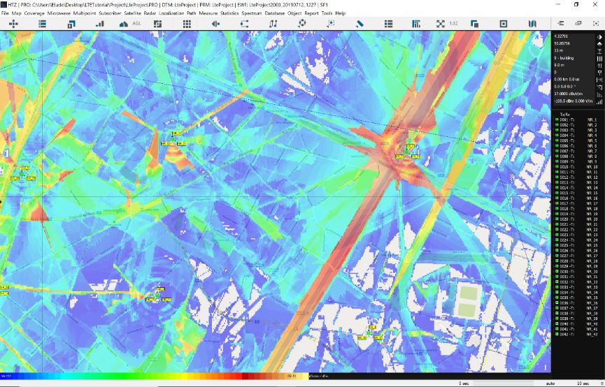
ATDI offers high-resolution terrain elevation and clutter maps for most countries across the World. These maps use geodetic projection ETRS89. The terrain and clutter layer files have root extensions RGE and RSO. The ATDI suite of tools accepts this file format, alongside the more familiar formats GEO and SOL.
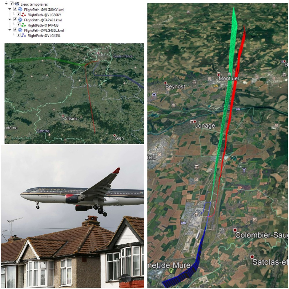
HTZ also features an export function that overlays coverage results from HTZ onto Google Earth maps.
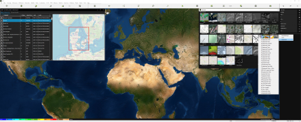
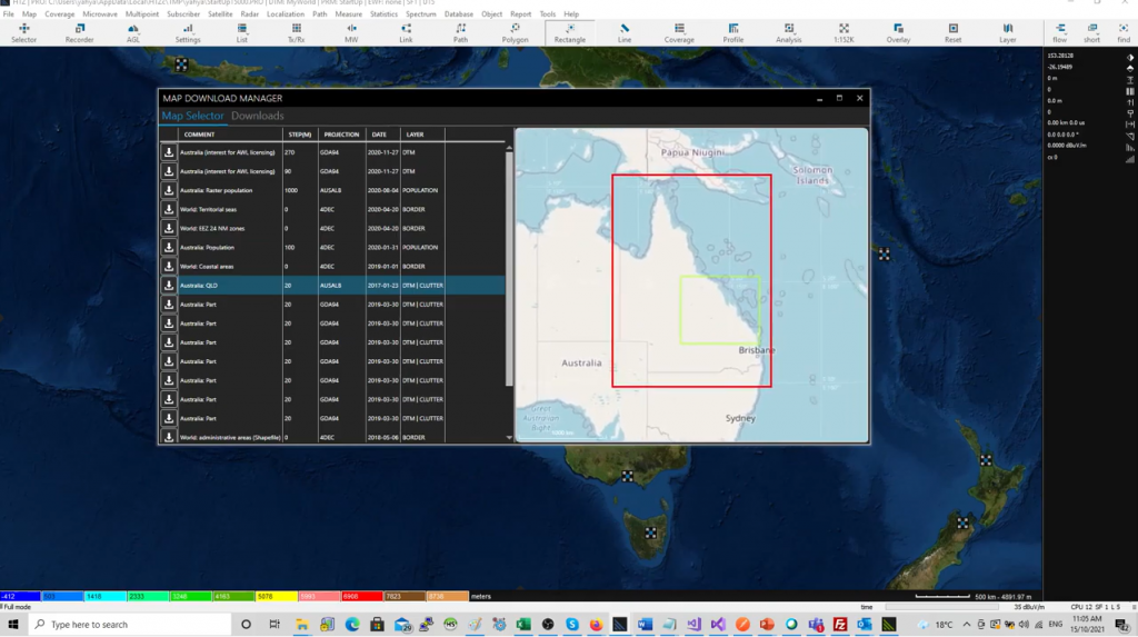
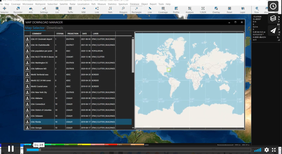
Check out the map data from our in-house library. Users can access these royalty-free datasets with a valid maintenance contract. All datasets are in ATDI’s proprietary format.
HTZ features a comprehensive map data toolkit for the production and manipulation of cartographic data from diverse sources including satellite images, aerial photographs and paper maps. Data produced are compatible with HTZ Warfare and HTZ Communications.
ATDI offers an online portal to allow users to identify and download pre-converted free-source maps. To view available map data for your area of interest, click here. Users with a valid maintenance contract who wish to download map data should log via our CRM.
HTZ communications feature a GIS engine that converts the GIS data from formats such as .TIFF, ASCII Grid, and .SHP files into ATDI formats, allowing the easy and efficient use of the data.
The GIS engine is able to create high-resolution building layers using DTM heights. This is based on the correlation between the digital surface model (DSM) and the digital terrain model (DTM).
ATDI also categorises clutter into classifications, as outlined below:
Urban areas in large towns/cities with mainly commercial, administrative and office buildings that are densely concentrated. There is little or no open space or vegetation.
Urban areas in large towns/cities with mainly commercial, administrative and office buildings.
Includes all industrial estates and areas of large warehouse type buildings
Small towns and areas of primarily residential buildings in larger towns / cities
Small settlements
Areas in towns/cities primarily used for recreation – e.g. golf courses or sports pitches
Areas of open land
Open areas within towns/cities – includes paved areas but not recreational areas.
Areas of trees
Any type of waterbody (natural or man-made).
Sharing coverage results to internal/external users
Modelling all radio communications technologies between 8KHz and 1THz
Modelling all radio communications technologies between 10KHz and 350GHz
Combining Medium & High-resolution maps into one layer
Webinar: 3D cartography and propagation raytracing
MW links -v- flight altitude analysis
Webinar: 5G – features & functions in HTZ


Εγγραφείτε στην επικοινωνία της
i-metrix για να μαθαίνετε πρώτοι τις προσφορές και τα νέα μας.
E-mail: info@i-metrix.gr
T: +30 210.300 2050
Ad: 20-22 Tzortz st. | Athens | GR